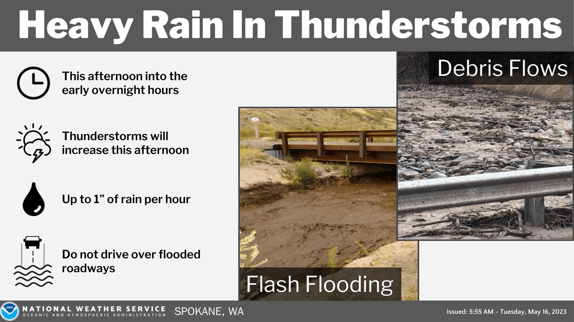
SPOKANE, WA – The National Weather Service says slow-moving wet thunderstorms are expected through tomorrow. The greatest coverage of thunderstorms will be today with heavy rain and isolated large hail. Flash flooding or debris flows will be possible this afternoon into the evening with burn-scarred areas and steep terrain most susceptible to flooding impacts from thunderstorms.
Thunderstorms will continue to be possible but are expected to be less so in coverage each afternoon. Friday and Saturday will be the hottest days of the week with record-breaking heat possible for both days. The warm temperatures will result in additional mountain snow melt with rivers running high.
|
| KEY POINTS |
- Wet, slow moving thunderstorms will increase the threat for flash flooding and debris flows by late morning into the afternoon and evening.
- Burn scared areas and steep terrain will be most susceptible to flooding/debris flows. Urban areas with poor drainage will see greater risk for flooding impacts as well.
- Rivers will continue to rise this week with warm temperatures melting high elevation snow.
- Moderate heat risk by Thursday, Friday and Saturday of this week.
|
| CHANGES FROM PREVIOUS BRIEFING |
| Issued a flood watch for much of eastern Washington and the Idaho Panhandle for the potential of flash flooding with thunderstorms today. |
| WEATHER RISK OUTLOOK |
| Risk levels incorporate potential impacts from weather hazards and likelihood of occurrence. |
| Tue 5/16 |
Wed 5/17 |
Thu 5/18 |
Fri 5/19 |
Sat 5/20 |
Sun 5/21 |
Thunderstorms
Heavy Rain/Hail
Rising Rivers |
Thunderstorms
Heavy Rain/Hail
Rising Rivers |
Rivers Running High
Thunderstorms Cascades |
Rivers Running High
Record Heat |
Rivers Running High
Record Heat |
Rivers Running High
Not as Hot |
| Risk Levels |
Little to None |
Minor |
Moderate |
Major |
Extreme |
|
| DETAILS |
| Northern Mountains, Central Panhandle Mtns, Northern Panhandle, Spokane, WA, Pullman, WA, Lewiston, ID, Wenatchee, WA |

Thunderstorms |
Impacts:
Small hail and gusty outflow winds
Timing:
Today and Wednesday
Confidence:
Moderate |
| Strongest thunderstorms may produce brief periods of large hail. |

Heavy Rain |
Impacts:
Flash flooding and debris flows
Timing:
Between 11 AM and 10 PM today
Confidence:
Moderate |
| Stronger thunderstorms with torrential rainfall will develop later this morning, becoming more scattered in nature this afternoon into this evening. Rain rates of an inch per hour or more will be possible. |
| Regionwide |

Heat |
Impacts:
Increased risk for heat related illness
Timing:
Hottest temperatures expected Friday and Saturday
Confidence:
High |
| Many areas will see record breaking temperatures for Friday and Saturday. |
|


