LEWISTON, ID – The National Weather Service in Spokane has released an interactive map to show Inland Northwest residents what kind of winter we are expected to have. The agency’s partners from the Climate Prediction Center provided a blog about the influence of La Niña on snowfall across the region.
“During La Niña, the jet stream, that river of air 30-40,000 feet in the atmosphere that serves as a storm highway, shifts northward across the eastern Pacific Ocean. This causes a ripple effect on the atmosphere across North America. A high-pressure system tends to set up south of Alaska in the north Pacific Ocean and acts like an atmospheric boulder, forcing storms up and around. Downstream over the eastern U.S., the jet stream then dips south in response,” the Center says in its blog.
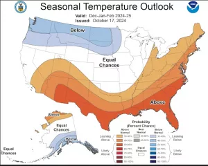
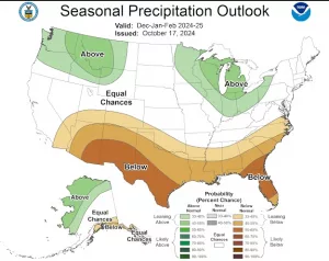
Overall, the Center says the Inland Northwest can expect below normal temperatures and above normal precipitation between December and February.
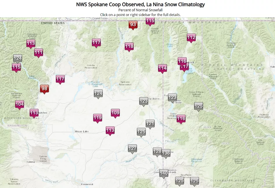
“As the blog states, for La Nina winters there is a tendency for above normal snowfall. Indeed, local research we’ve conducted for several cities across our region show a tendency for above normal snowfall. As shown below, on average snowfall ranges from 110-125% of normal for La Nina Winters,” NWS says.
For the Lewiston area, the early forecast is for 140% of normal snowfall (avg. 22″); Pullman residents should see 128% of normal snow(avg. 46″); the Moscow area is expected to have 136% of normal snowfall (avg. 67″); and Winchester and Nezperce residents can expect 125% of normal snowfall (avg. 113″/52″).


