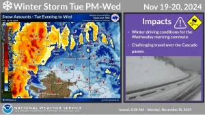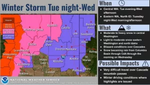
LEWISTON, ID – Significant winter weather conditions will impact the Inland Northwest over the next few days, particularly across north-central Washington. The National Weather Service says heavy snow is expected in the valley areas tomorrow and Wednesday, and blizzard conditions are expected near the Cascade crest. Light to moderate snow is expected across the upper portions of the Columbia Basin into northeast Washington, into the Idaho Panhandle and Palouse.
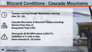
“Blizzard conditions along Highway 2 over Stevens Pass will result in blowing snow with visibility below a quarter mile possible. Strong winds in the Cascades could also result in extensive damage to trees and power lines. Heaviest snow will fall overnight Tuesday into Wednesday morning with impacts to the morning commute expected,” the NWS says.
Two additional storm systems are expected through the rest of the week, but snow levels will rise, with rain in the lowlands and additional snow in the mountains.
NWS meteorologists say storm system #2 will bring very heavy mountain snow, blizzard conditions on Stevens Pass, and light to moderate lowland snow. There is a potential for snowfall rates of one to three inches per hour.
The third storm system, arriving Thursday and Friday, will have moderate mountain snowfall, while the lowlands weather will switch to rain. Mountain snow showers are expected to continue over the weekend.


